
A dozen or so times a year I am asked by colleagues and interested readers alike “Just where are the Talpiot tombs located in relationship to the city of Jerusalem?” Some of these questioners are interested in visiting these tomb locations, whereas others are just wanting to get a sense of how far south of the Old City these tombs lie. If you want an update on these tombs and what they might signify, since the controversy surrounding them has been so confusing, see my comprehensive summary post: “The Top Twenty Fictions Related to the Talpiot Tombs.”
The short answer is they are just less than 2000 meters due south of the Pool of Siloam–which in Herodian times was the southern extent of the Old City. In fact, the longitude of the eastern Wall of the Old City is precisely the same as that of the tombs. Maps are helpful but sometimes a visual image is worth more than a thousand words. Recently, down at the Pool of Siloam, I took this photograph with the Talpiot hills just in the distance.
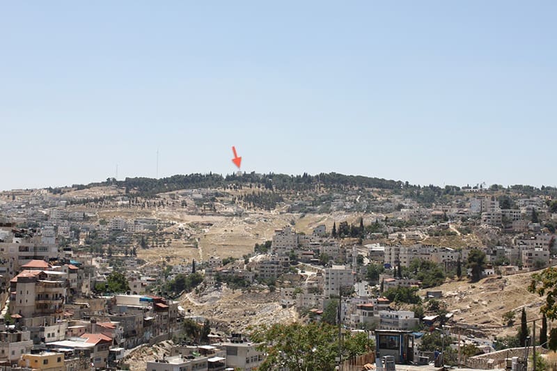
You can see the flag over the United Nations building in the center of the photo, indicated by a red arrow. It is located on what has been traditionally called “the Hill of Evil Counsel,” where Judas Iscariot met with the leaders of the Sanhedrin and was paid 30 silver pieces to betray Jesus. The Talpiot tombs are just a few hundred feet below that ridge, on the other side.
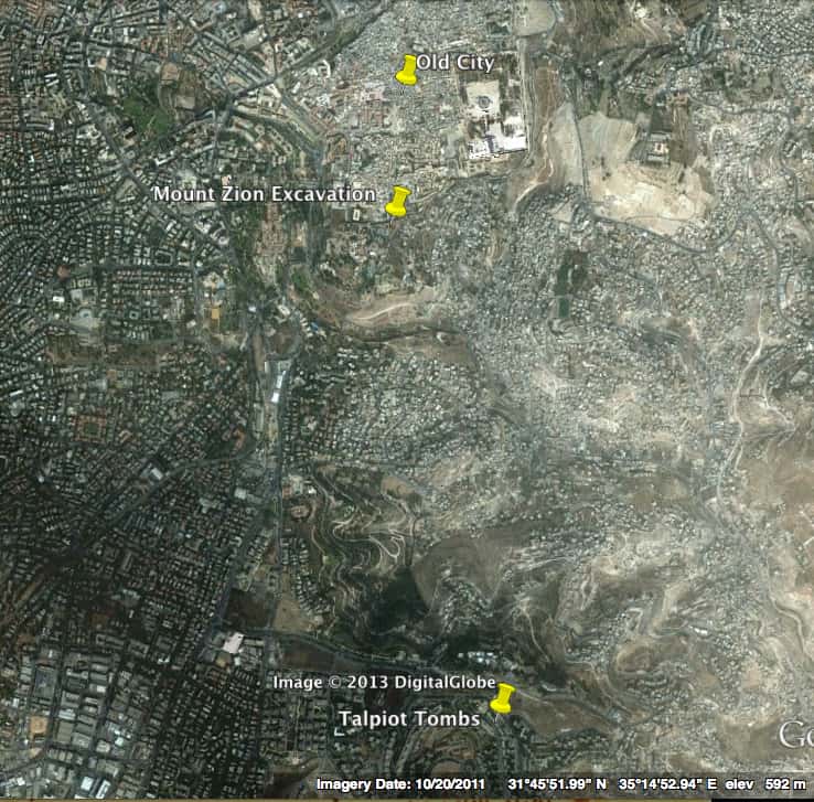
The Google map helps put this photo into a bit of a better perspective in terms of distance and direction:
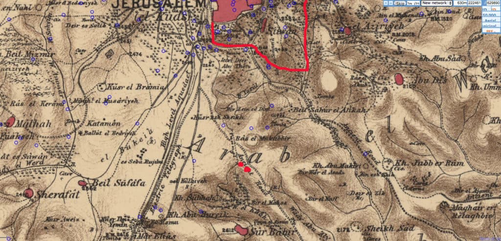
Here is the Palestine Exploration Fund map of 1880 that shows the terrain. Also note that the areas outside of the Old City are quite sparsely developed. The southern walls of Herodian Jerusalem are marked and the two Talpiot tombs are indicated by the red dots. Note that the tombs are just above a major road that leads out to the Judean Desert, running right to Mar Saba:
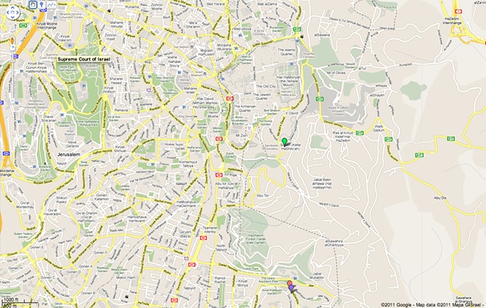
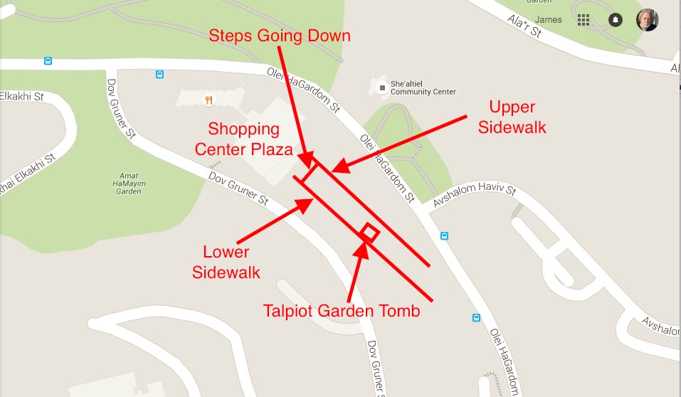
Finally, here is a close up of the area today on a Google map with the streets and locations of the tombs indicated; Tomb 2 in pink and Tomb 1 in purple:
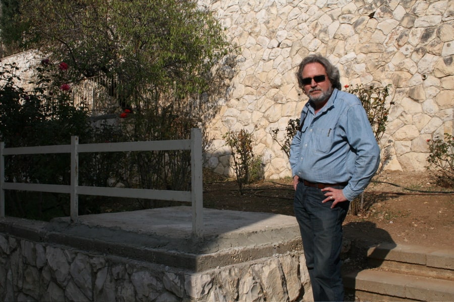
I hope these photos and maps will serve any who are wanting to locate the Talpiot tombs, whether to walk to the area or just to study more closely their locations. For those wanting to visit the best route is to go first to the well-known Haas Promenade, south of the Old City. From the Promenade walk south down David Raziel Street to the traffic circle and go east on Olei Hagardom Street. Follow this around to the shopping center on your right where Dov Gruner Street intersects. Both tombs are located between the condominium complexes between Olei Hagardom and Dov Groner. You can cut through the plaza of the shopping center and there is a pedestrian sidewalk between the two complexes, one upper the other lower. The “Jesus” garden tomb is along the lower level of this sidewalk, covered now with a concrete slab. The nearby Patio tomb you will not be able to see as it is under the first condominium after the shopping center on Olei Hagardom. If you get lost most of the neighbors who live there will be happy to show you the spot of the Jesus tomb–but you can’t miss it. Here is a detailed map and photo of what the “garden tomb” area looks like:


Comments are closed.